For this post, I suggest the following:
- Pour your favorite beverage
- Find a comfortable few minutes
- Reading this post on a tablet or laptop may improve your visual experience
- Maybe put on your favorite Ralph Towner album or cue up some R. Carlos Nakai
Flying between Los Angeles and Chicago in late summer, I had the good fortune to see geologic formations and patterned colors in the American Southwest and Midwest.
Weather in the form of clouds made an appearance (but was mostly absent, thankfully), and Chicago’s legendary architecture served its singular urban design in aesthetically pleasing buildings.
Eastward views
On the outbound flight, the plane headed northeast towards Las Vegas. I had my phone in airplane mode, so the GPS tags are absent. Based on the time stamp of these pictures and shots of the flight’s route on my seatback screen, I am estimating where they were taken. The engineering feats required to get a jet into the sky aside, I began to marvel at what passed below, a ribbon of arresting images.
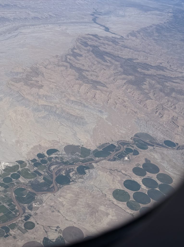
First up, green circles popped out. These water wheel fields are maintained by a rotating irrigation system following a static path. Edges were sharply delineated, as if etched by an agricultural compass with a center point. The circles varied in size. Some were only three-quarters of the pie. There were semispheric circles too, and a few conventional rectangles. What crops are growing there?
Also visible were roads and a muddy waterway which included an oxbow. I had the impression that the landscape is biding its time, given the ages which have come before, and which will outlast us all.
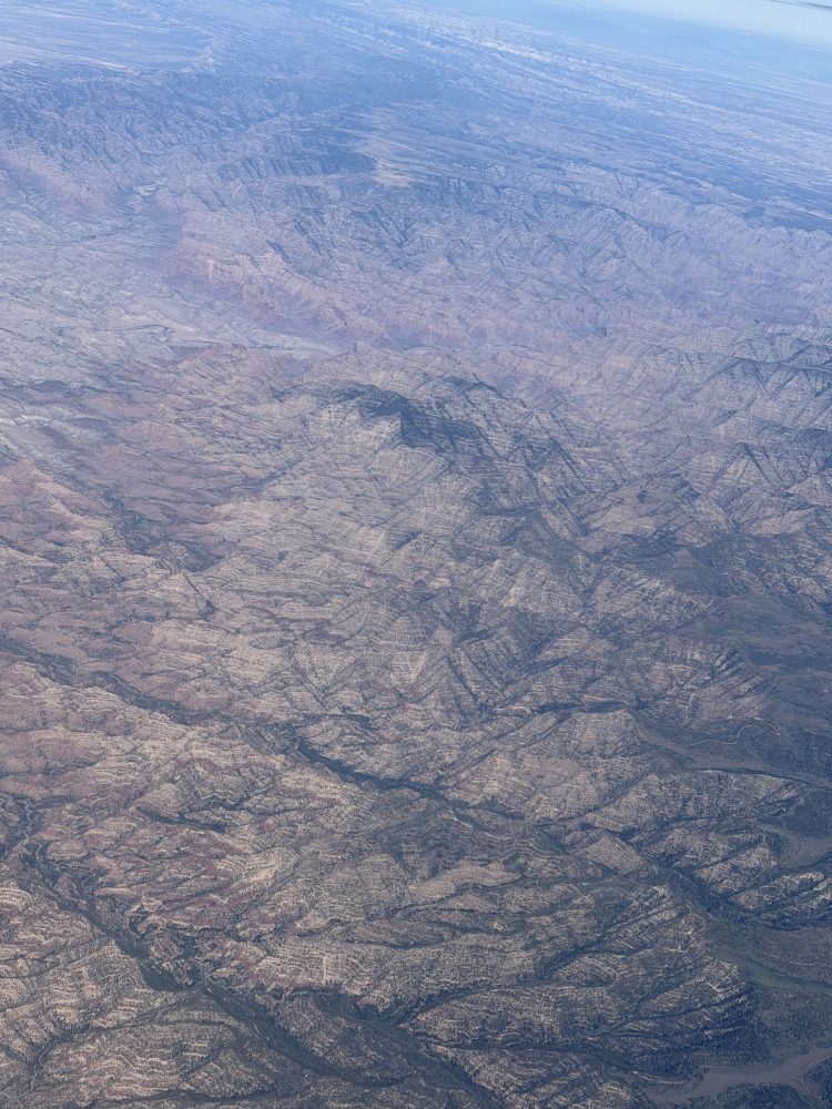
Next up is a series of subtle color variations evoking the Painted Desert in Arizona. Looking closely, the red, taconite-hued rock is located below pale sandstone-colored striations. Sparse tree growth is visible, particularly in the riverbeds. The photograph reminds me of M.C. Escher’s Metamorphosis series, in which a visual game is played: are the tops of these landscapes really the tops, or might the inverse be true? Are they concave or convex?
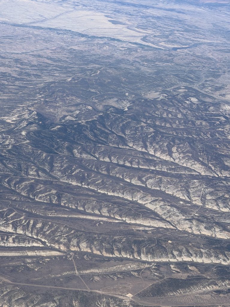
Riding on abstract expressionist vibes, this landmass sailed in. Was it skeletons of giant sea creatures, remnants of an ancient Medusa, or even a plaited earth? What causes this pattern? It illuminates the passage of time and the power of erosion and wind on the earth.
At the eastern edge of Nebraska, the Missouri River came into view. The land is now gridded, hemmed in by roads, a stitched quilt of tidy parcels, most of them of a square mile, or 640 acres.
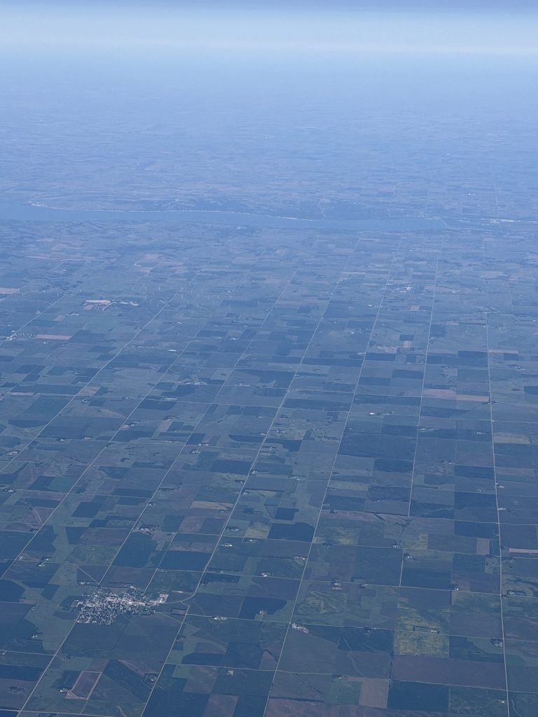
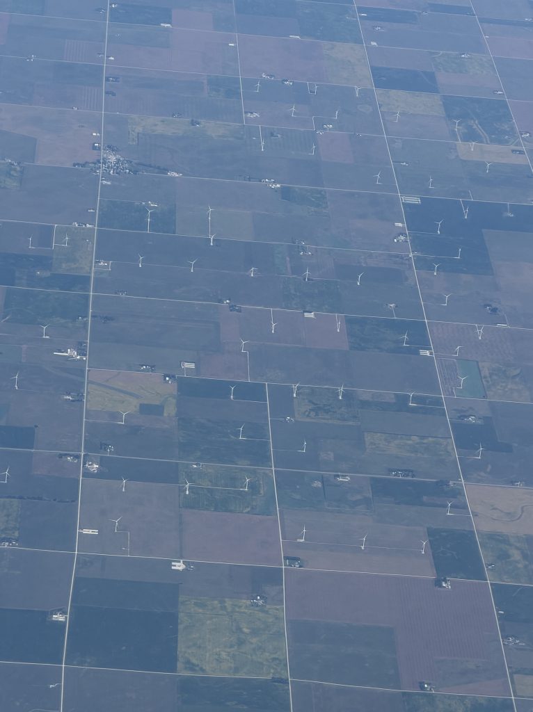
Somewhere near Waterloo, Iowa, wind farms popped up. I noticed the absence of visible farmhouses on these squares. Industrial-scale agriculture is surely a factor.
Get Thee to Chicago
Chicago’s downtown did not disappoint. Over the past 150 years, architects and engineering firms have melded the city into a unique cityscape. The slate of extraordinary buildings includes the Monadnock Building, with its six-foot-thick walls at street level, skyscrapers (The Rookery), Spanish Colonial (the Wrigley building), Gothic revival (Tribune Tower), Modernist (Marina City), and beyond. A boat tour with the Chicago Architecture Center is a relaxing way to appreciate some of the downtown area’s important buildings and instances in which newer buildings tip their design hats to their older neighbors.
Maybe your interests lean toward engineering. How to wrangle wind and torque in 100-plus story structures as in the Willis Tower? How to build the Boeing headquarters over Union Station without interfering with the train tracks? How did they wrestle the Chicago River to manage the, ahem, waste of a major manufacturing hub and its residents?
No matter. You’ll relish a chance to sit down and take in this stellar urban planning achievement after visiting the museums, the Shedd Aquarium and Millennium Park. The tour is a fantastic introduction to how Chicago’s powers-that-be buried the remnants of the 1871 fire east of what is now Michigan Avenue – buried them in Lake Michigan — and built out an impressive metropolitan landscape.
David Rumsey’s collection of digital maps includes this one, made by Samuel Augustus Mitchell Jr. in 1868, three years before the fire destroyed the wooden structures of downtown Chicago. Zoom in and you’ll see that going east from State Street in downtown Chicago, it’s merely two streets until Lake Michigan’s shore!
N.B. Erik Larson’s The Devil in the White City is an informative read if you’re keen to know a bit more about the World’s Columbian Exposition in 1893 and subsequent evolution of architecture in Chicago after the fire.
Partly Cloudy Forecast
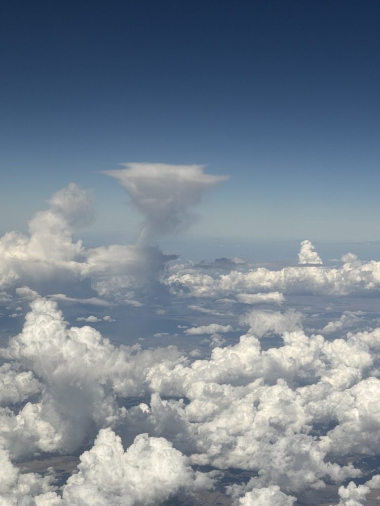
Flying home to Los Angeles, I had a window seat and saw several elegant cloud formations. Having viewed Georgia O’Keeffe’s Sky Above Clouds IV at the Art Institute of Chicago (the last in a series of the Cloud paintings she completed, informed by her air travel in the early 1960’s), I was attentive to what was outside the jet’s window.
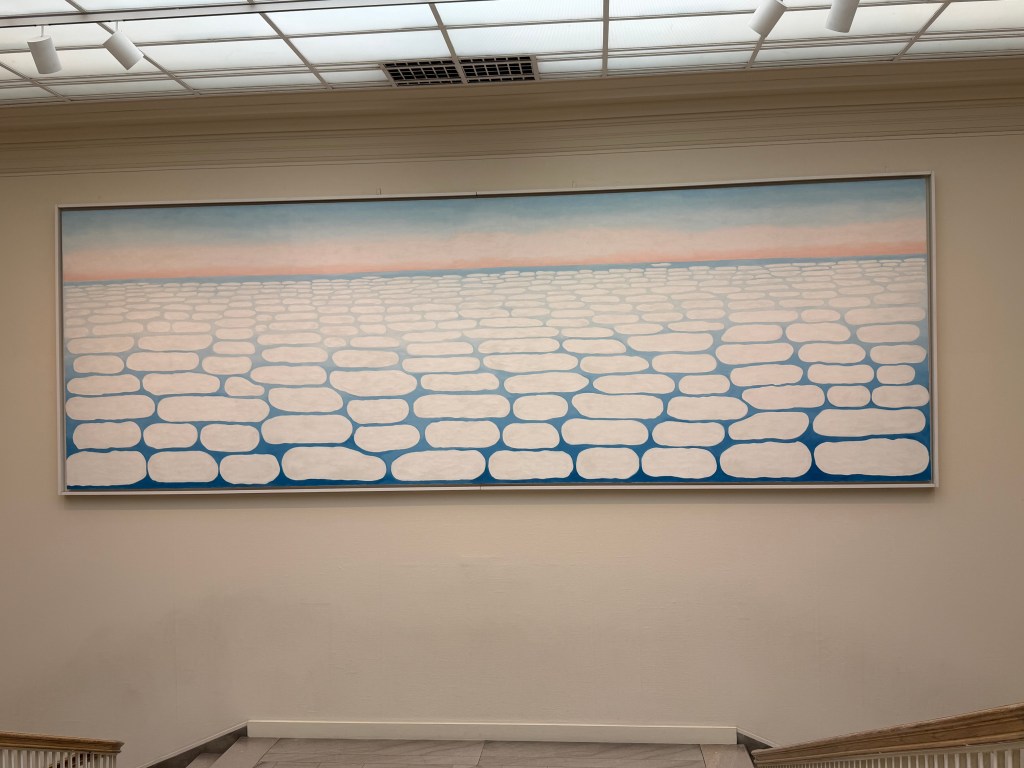
Here’s a series of clouds which reminded me of a caterpillar, inching along with its shadow cast below.
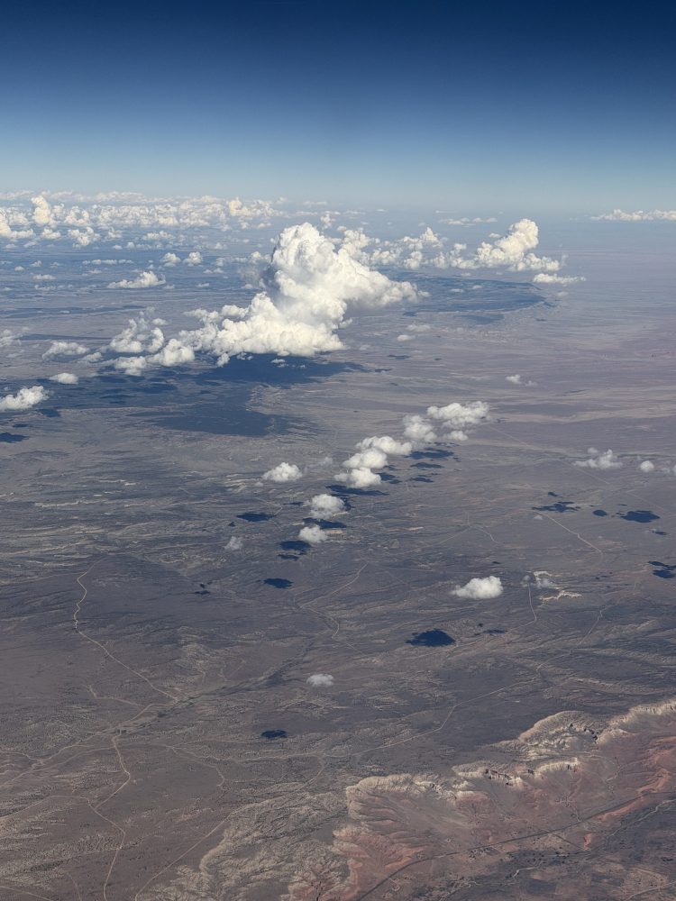
Further on, an anvil head looked as if it had decided not to grow into a mature cloud, as if the view from above was enough of a reward.
Westward Travel
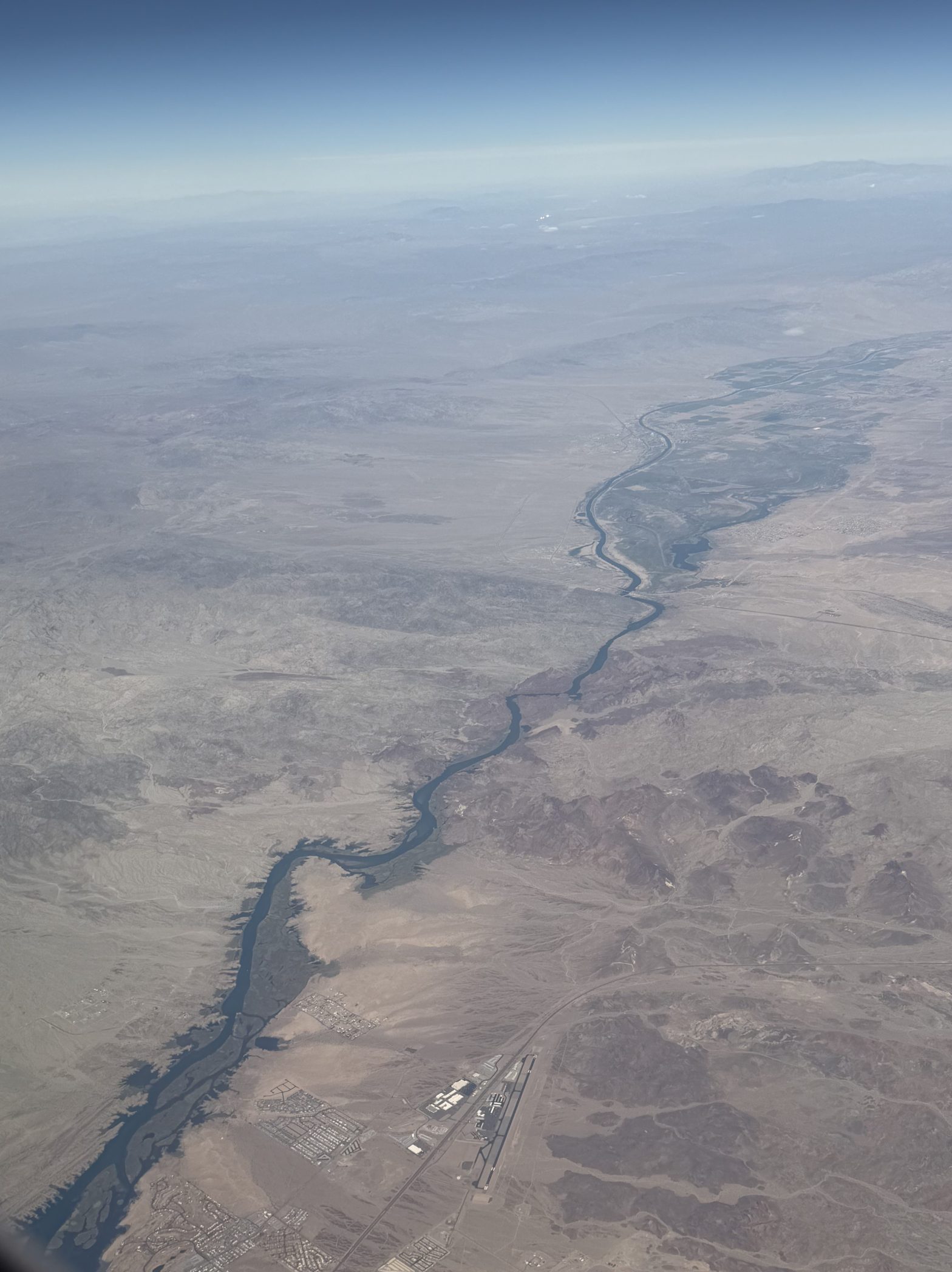
The flight home attached GPS tags to the pictures even though my phone was in airplane mode. This picture of the Colorado River is remarkable.
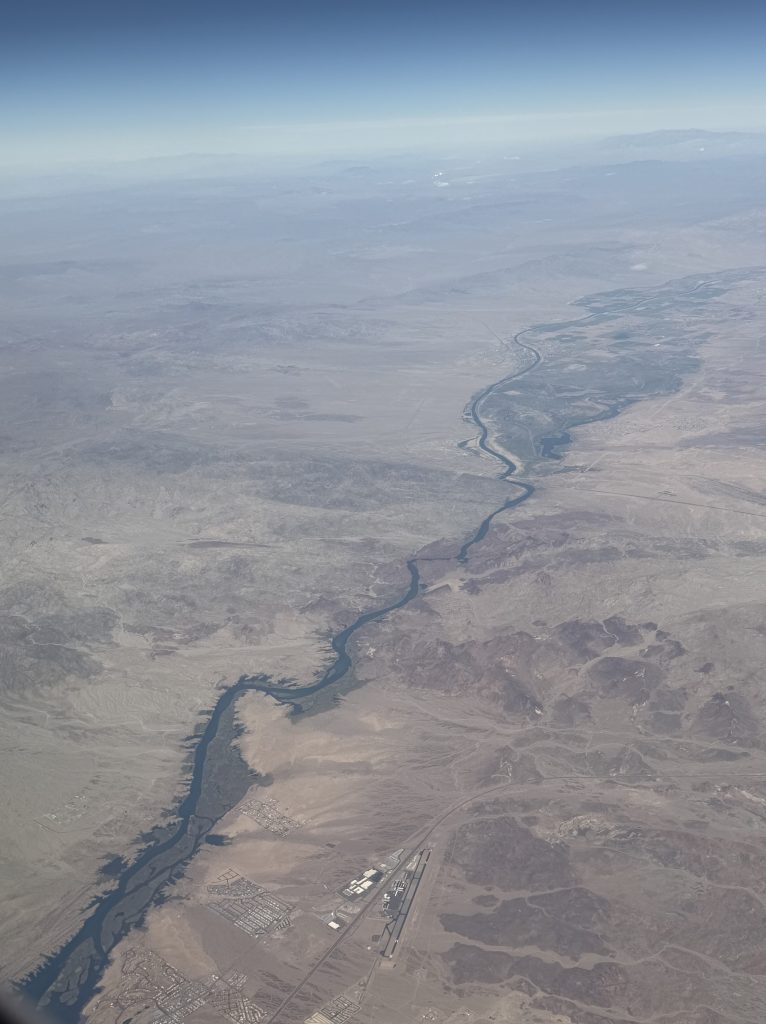
Taken above Lake Havasu City, Arizona, about 325 east of Los Angeles, the image reminded that the Colorado River has been a major source of water for the southwestern United States. But this looked more like a stream than a river.
The Colorado has been in the news because of the decline in water available to the state of Arizona. The New York Times published a recent story with this stunning detail:
“The Colorado supplies water to 40 million people, 5.5 million acres of farmland and about two dozen native tribes. Two Mexican states also use the river.
“But the waterway has transformed since communities first began tapping it. Its flow has diminished by about 20 percent across two decades of drought, a period scientists say is the driest for the Southwest in 1,200 years.”
(U.S. Announces Colorado River Cuts for 3 States Amid Drought, Scott Dance, The New York Times, 8/21/2026).
This water source flows in a vast network, to destinations including the Imperial Valley, where produce grown in the winter keeps us nourished with vegetables. The drought in the southwestern U.S. is aggravating the problem of thirsty cities and diminished precipitation. This puzzle’s solution will impact us all.
A million things must come together in perfect order to complete a trip that we might think of as routine. Not having thought about lessons from my geology classes in ages, I reveled in my appreciation of land forms, the natural world’s response to wind, water and time, and the palette of the land’s colors. Getting to Chicago for a visit in September was a memorable treat. As the view from 35,000 feet unfurled in a slow-motion film, it renewed my appreciation for the staggering beauty of this planet we all call home.

